What's New in v1.1.0 (Build 10)
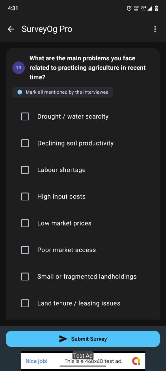
• Offline Field Data Collection Suite: Capture qualitative interviews and
quantitative surveys with full audio and photo attachments.
• High-Precision GIS Spatial Engine: Capture Points, Lines, and Polygons with
interactive midpoint insertion (+) and real-time vertex dragging.
• Live Geodesic Metrics: True geodesic distance and polygon surface area
calculation (sq.m, hectares, acres).
• Dual-Frequency GNSS Telemetry: Real-time satellite inspection, L1/L5 carrier
frequency, and horizontal/vertical accuracy telemetry.
• 100% Offline Multi-User Isolation: Multi-user on-device storage slots prevent
cross-user data leakage.
• Android 16 Readiness: Upgraded to targetSdk = 36 with R8 full-mode
optimizations.
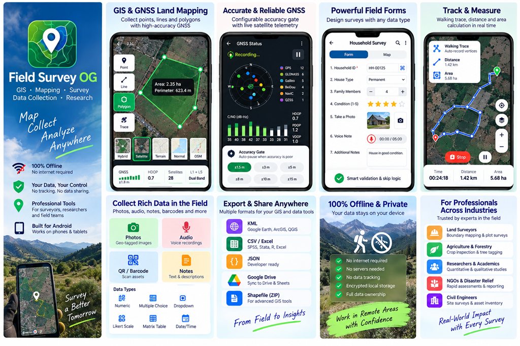
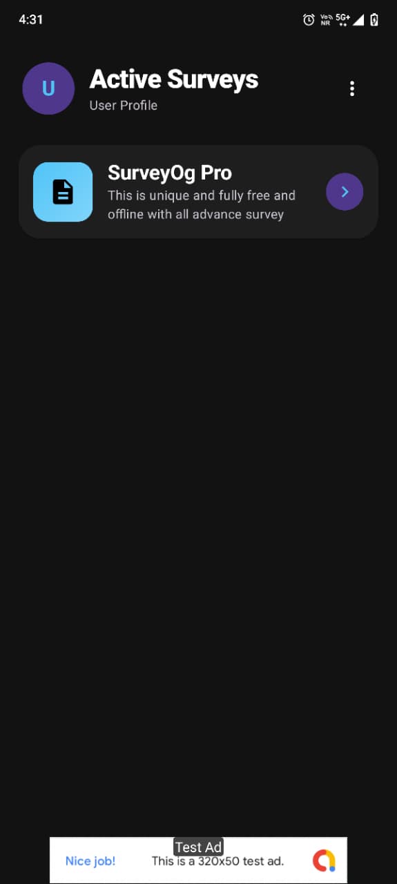
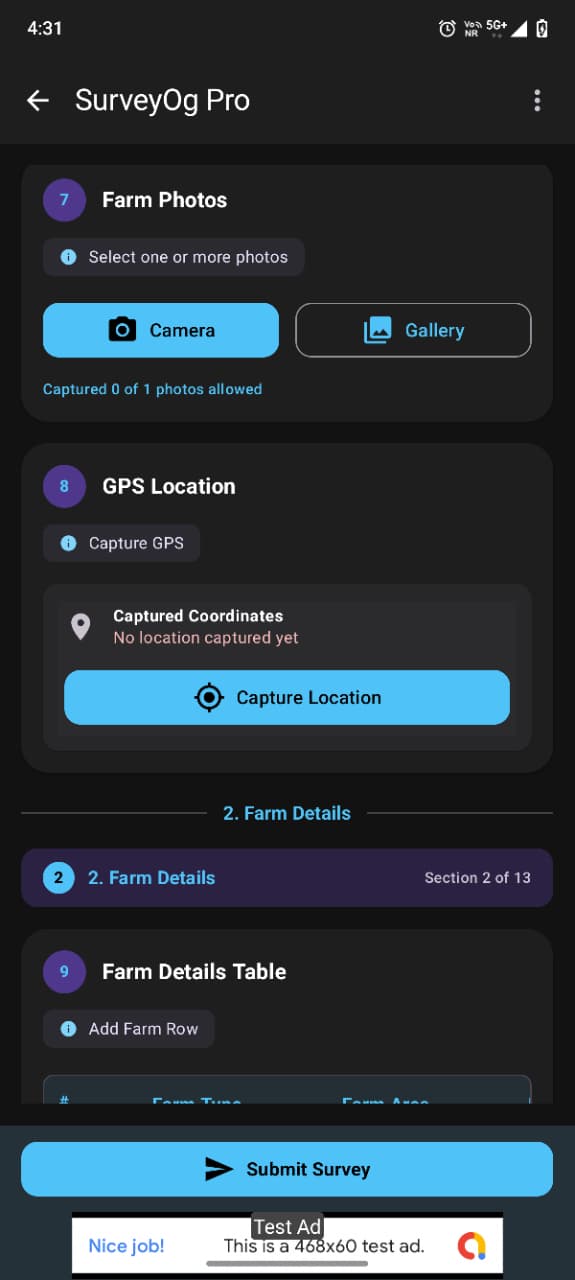
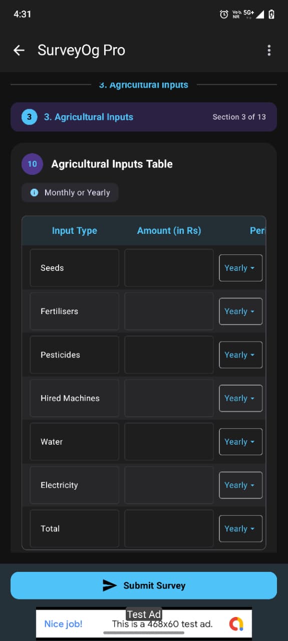
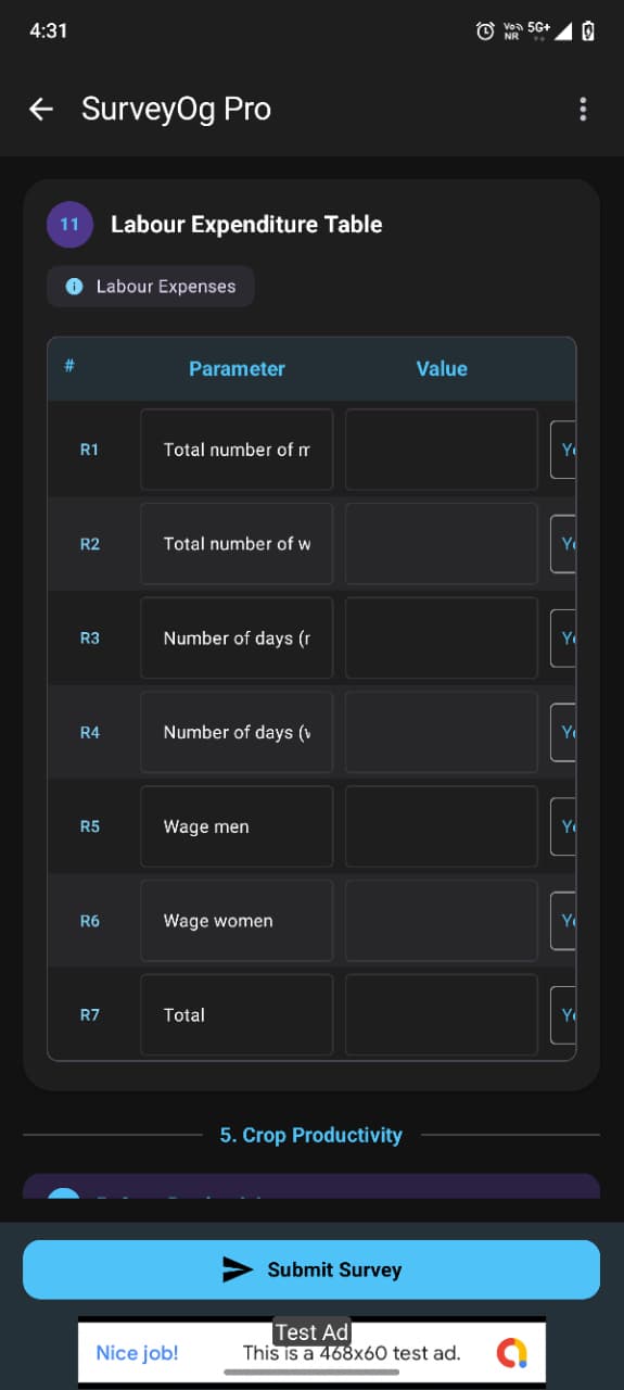
App Screenshots & Interface
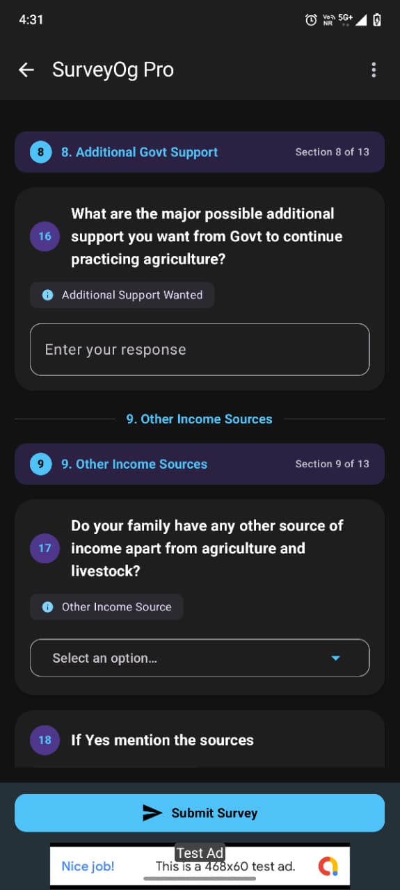
Click the landscape feature graphic or any screenshot to view in full resolution lightbox.
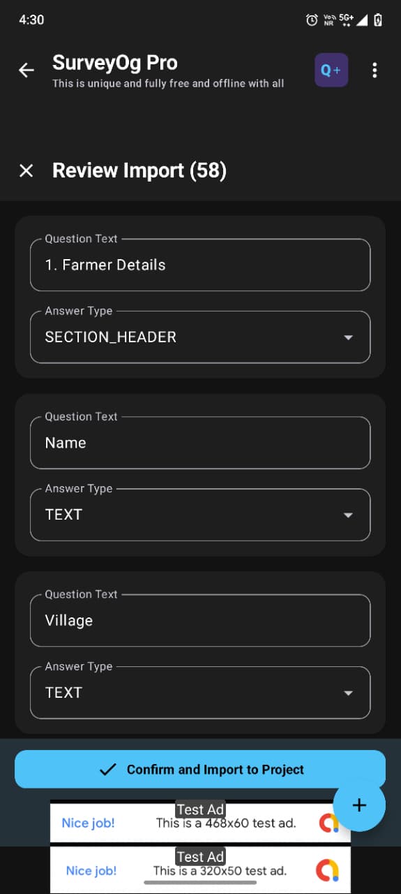
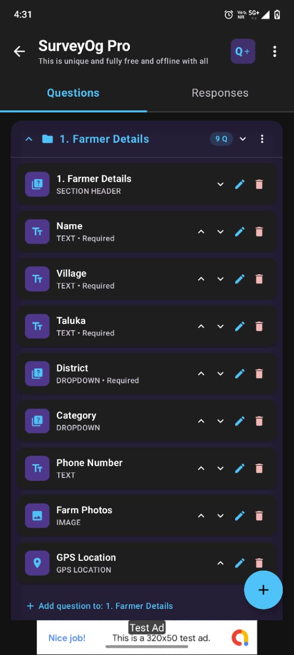
In-App Mobile Screens (Portrait)
Comprehensive Capabilities
Qualitative & Quantitative Research
Conduct in-depth field interviews with live audio recordings, open narratives, and annotated photo evidence. Simultaneously run quantitative statistical surveys with Likert rating matrices and validated numeric grids.
Dynamic Skip-Logic Form Builder
Design complex adaptive questionnaires with conditional branching rules, mandatory questions, cascading dropdowns, barcode/QR scanners, and digital signature capture.
High-Precision GIS Spatial Engine
Collect high-precision Points, Lines, and Polygons directly on cached offline maps. Use touch placement or real-time GPS fixes with interactive vertex dragging and dynamic midpoint insertion (+).
Real-Time Geodesic Area Metrics
Calculate line lengths (meters/km) and true polygon surface area (sq.m, hectares, acres) along the WGS84 ellipsoidal curve as you walk parcel perimeters or tap map vertices.
GNSS Satellite Telemetry
Monitor multi-constellation satellite telemetry (GPS L1/L5, GLONASS, Galileo, BeiDou), Carrier-to-Noise density ($C/N_0$), and HDOP precision bounds to ensure survey accuracy.
Research & Spatial Export Suite
Export research datasets to clean tabular CSVs ready for desktop statistical software and spreadsheet analysis. Export spatial boundaries to standard OGC KML/KMZ and GeoJSON layers with bundled photo evidence.
Technical Specifications
| Platform & Store | Android™ (Official Google Play Store) |
| Target Audience | Field Researchers, Social Scientists, NGOs, M&E Teams, Agronomists, Civil Engineers & Land Surveyors |
| Research Methodologies | Qualitative (Interviews, Audio, Photo notes) & Quantitative (Likert scales, Numeric matrices) |
| Spatial Geometry | Points, Polylines, Polygons with live Geodesic Area (WGS84) |
| Target SDK | Android 16 (Target SDK 36 Readiness) |
| Minimum Operating System | Android 8.0 (Oreo, API level 26) or higher |
| UI Architecture | 100% Modern Jetpack Compose with Material 3 |
| Spatial & Vector Formats | OGC-Compliant KML, GeoJSON, CSV, Shapefile-compatible attributes |
| Required Permissions |
• Location (Precise & Approximate): For GIS stamping and boundary
mapping. • Camera: For survey photo questions and field evidence. • Storage/Media: For local database backups and CSV/KML exports. |
| Account & Data Deletion |
Fully compliant with Google Play Data Safety policies. Delete anytime via Web Deletion Form or inside app
via Settings > Danger Zone.
|
Comparison: Why Field Researchers & Surveyors Switch to SurveyOg Pro
Looking for an autonomous, server-free solution for professional field data collection and boundary mapping? Here is how SurveyOg Pro compares against server-dependent and basic mapping tools:
| Capability / Feature | SurveyOg Pro (Our App) | Server-Dependent Cloud Survey Tools | Basic Mobile Area Measurement Apps |
|---|---|---|---|
| 100% Offline Autonomy | ✅ Zero server setup · Complete on-device autonomy | ⚠️ Requires central server (complex backend server setup) | ✅ Offline GPS (basic coordinates only) |
| Geodesic WGS84 Land Area | ✅ Sub-meter legal ellipsoid · Walk boundary perimeter | ❌ Basic planar or external GIS needed | ⚠️ Planar approximation (distorts large plots) |
| GNSS Satellite Telemetry (L1/L5) | ✅ GPS, GLONASS, Galileo, BeiDou · C/N0 & HDOP metrics | ❌ Single GPS accuracy radius only | ⚠️ Limited satellite inspection |
| Dynamic Skip-Logic Forms | ✅ 14+ question types · Conditional branching on-device | ✅ Supported (requires XLSForm authoring) | ❌ No questionnaire form engine |
| Qualitative Audio & Photo Notes | ✅ In-app audio interviews + compass-stamped photos | ✅ Supported | ❌ No audio interviews or Likert scales |
| Spatial & Tabular Export | ✅ OGC KML, GeoJSON & CSV in 1-tap | ⚠️ Server sync required before desktop export | ⚠️ KML export often locked behind paywall |
| Multi-User Device Isolation | ✅ Independent profile slots on shared field tablets | ❌ Mixed responses in single storage | ❌ Single user profile only |
| Regional Land Units | ✅ Bigha, Acre, Guntha, Hectare, Sq.M, Marla, Kanal | ❌ Manual post-processing formula needed | ⚠️ Standard metric / imperial only |
| Privacy & Data Safety | ✅ 100% Client-Side · Zero telemetry · Target SDK 36 | ⚠️ Cloud dependent | ⚠️ Ad tracking banners in free tiers |
Real-World Use Cases & Industry Workflows
SurveyOg Pro is deployed across rural development, commercial agriculture, public infrastructure, and academic field research worldwide:
Agronomy & Crop Scouting
Agricultural Officers & FarmersWalk farm parcel boundaries to compute legal acreage and Bigha. Record crop varieties, fertilizer usage, pest infestations, and attach geotagged leaf damage photos without needing cellular data.
NGO Socioeconomic Baseline
M&E Specialists & Field TeamsDeploy household demographic surveys in remote indigenous communities. Leverage dynamic skip logic to streamline interviews and record high-fidelity qualitative voice audio with zero server costs.
Cadastral & Boundary Mapping
Land Surveyors & ValuersVerify property boundary disputes by recording multi-constellation GNSS vertices along fences and roads. Fine-tune boundary points with interactive midpoint insertion (+) and vertex dragging.
Civil Infrastructure & Utilities
Site Engineers & MunicipalitiesMap rural pipeline routes, electric pole positions, and road alignments. Export surveyed geometries directly into standard RFC 7946 GeoJSON and OGC KML for seamless import into desktop GIS suites and CAD platforms.
Step-by-Step: How to Measure Land Area Walking GPS
Learn how to map any land parcel, farm boundary, or building plot using SurveyOg Pro on your Android smartphone:
Create Project & Set Units
Open SurveyOg Pro and tap New Project. Choose Polygon Survey and select your preferred measurement units: Acres, Hectares, Square Meters, or Bigha.
Verify GNSS Satellite Fix
Inspect the on-screen GNSS satellite telemetry panel. Ensure Carrier-to-Noise ($C/N_0$) is strong and horizontal precision (HDOP) is below 1.5 meters for maximum survey precision.
Walk Plot Perimeter
Toggle Live Boundary Walk and walk around the perimeter of the field. SurveyOg Pro drops precision coordinates along the WGS84 geodesic curve in real time.
Close & Export (KML / GeoJSON)
Tap Close Polygon when returning to your starting marker. Review the total acreage and perimeter, then export directly to standard KML, GeoJSON, or CSV.
Common Questions About SurveyOg Pro & Mobile GIS
How does SurveyOg Pro eliminate the need for external survey servers and cloud hosting?
Unlike conventional survey suites which require configuring a central web server and paying for monthly cloud hosting, SurveyOg Pro operates 100% autonomously on-device. It requires no server setup, offers 14+ question types with conditional skip logic, captures geotagged photos and audio interviews, and natively calculates WGS84 geodesic land area without external plugins.
How do I measure farm acreage by walking the boundary with a phone?
Open SurveyOg Pro, start a Polygon Survey, and toggle 'Live Boundary Walk'. As you walk along the parcel perimeter, GNSS fixes are recorded and rendered live on your map, calculating true geodesic area in Acres, Hectares, Sq. Meters, and Bigha on the WGS84 ellipsoid.
What is geodesic surface area vs flat Cartesian calculation?
Cartesian planar calculations assume the Earth is flat, which introduces legal-level distortion over large land plots. Geodesic calculations follow the curved WGS84 Earth ellipsoid, delivering millimeter-to-sub-meter surface accuracy.
How does SurveyOg Pro combine spatial boundary mapping with rich qualitative surveys?
While standard boundary mapping apps focus strictly on raw GPS coordinates, SurveyOg Pro combines high-precision spatial boundary mapping with an enterprise qualitative and quantitative survey form engine. Surveyors can attach audio interviews, complex conditional questionnaires, and photo evidence to any parcel or waypoint.
Can field teams conduct surveys completely offline without cellular reception?
Yes. SurveyOg Pro operates 100% offline. Maps can be pre-cached, questionnaire forms with conditional skip-logic execute locally, and photos and audio notes are stored securely on the device without requiring cell reception or internet.
How do I export survey layers to GIS mapping software?
Tap 'Export Project' and select OGC KML/KMZ or RFC 7946 GeoJSON. SurveyOg Pro compiles all boundaries, waypoints, photos, and form answers into standard packages that open seamlessly in standard mapping tools and desktop GIS suites.
What GNSS satellite constellations does SurveyOg Pro monitor?
SurveyOg Pro inspects real-time raw satellite signals across GPS (L1/L5), GLONASS, Galileo (E1/E5a), BeiDou, and QZSS. It reports live Carrier-to-Noise density (C/N0), azimuth, elevation, and Horizontal Dilution of Precision (HDOP) to ensure data accuracy.
Does SurveyOg Pro support local land units like Bigha and Guntha?
Yes. SurveyOg Pro supports international standard units (Square Meters, Square Kilometers, Hectares, Acres, Square Feet) as well as regional land surveying units including Bigha (standard and regional definitions), Guntha, Kanal, and Marla.
How does multi-user profile isolation protect field researchers on shared devices?
When multiple enumerators share the same Android phone or field tablet, SurveyOg Pro provides isolated on-device profiles. Each surveyor logs into their dedicated profile slot, ensuring questionnaires, draft responses, and audio files cannot be overwritten or accessed by other enumerators.
Is SurveyOg Pro compliant with Google Play Data Safety and Android 16?
Yes. SurveyOg Pro targets Android 16 (Target SDK 36), complies with Google Play Data Safety policies, collects zero commercial ad telemetry, and provides both an in-app and web portal for complete user account and data deletion.
Equip your team with SurveyOg Pro today.
Available directly on Google Play for all Android smartphones and field tablets.